5 Easy Hikes in Marin County

By Matt Dolkas,
Senior Manager, Marketing
January 3, 2025
I’m always on the lookout for easy hikes in Marin County.
My wife will be the first person to tell you that I’m a pretty lazy hiker (thanks, babe). It’s not that I don’t love a good long hike, but with two kids in tow, an energetic dog, the most ridiculously enormous stroller and a standard ration of snacks that could satisfy a small football team…well, sometimes just getting out of the house is enough of a challenge.
Gentle trails, easy parking areas and great views is the name of the game for me these days. And what keeps me motivated is that our family tends to be at its best when we’re together outside, enjoying Marin’s abundance of open spaces (much of which is thanks to MALT). It’s become somewhat of a ritual for us, where we go to get grounded by simply being together outside.
Whether you’re new to the activity or just looking for new trails to try, there’s something for everyone out there—all ages and abilities. Below you’ll find 5 of our family’s go-to spots (in alphabetical order) for easy hikes in the West Marin area. They’re tried and true and we hope to see you out there.
Take it easy!
Distance: 2.3 miles round trip
Elevation gained: 200 ft
Wheelchair accessible: Yes*
Dog-friendly: No, sorry
Find driving directions by clicking here
Restroom: Yes
Managing Agency: National Park Service
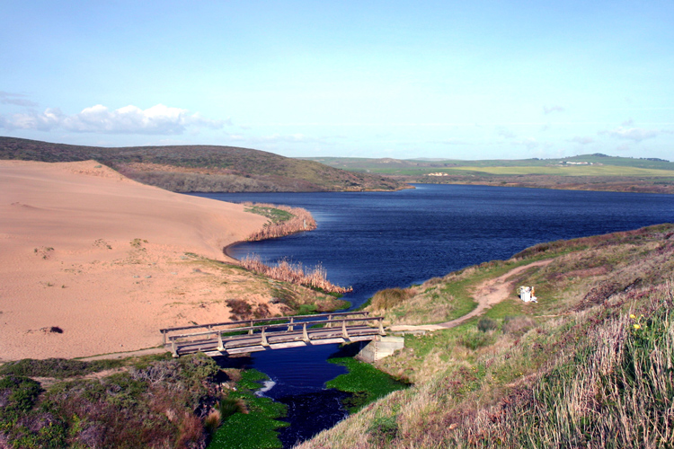
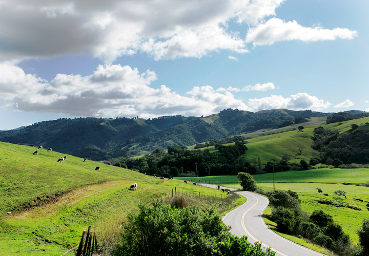
Overview: One of our favorite parts about this hike is the drive to the trailhead, deep within the Point Reyes National Seashore. No matter which direction you come from, you’ll pass miles of scenic farmland, towering redwoods and clear watered creeks in West Marin—much of which has been protected by MALT.
Abbots Lagoon is a fantastic place to see birds, especially in the fall and winter during the seasonal migration. So, be sure to bring a pair of binoculars as you’re likely to find a diversity of feathered friends. It is also a great place to see spring wildflowers so plan a visit for early April too.
*The first quarter mile of this trail is comprised of a well-graded, soil-cemented trail to an overlook of the lagoon. It’s wheelchair accessible and good for our large stroller too. After the foot bridge the trail turns to sand and it’s best to go on foot from there if you’re able.
Distance: 8.2 miles (shorter options available)
Elevation gained: 400 ft
Wheelchair accessible: Yes
Dog-friendly: No, sorry
Find driving directions by clicking here
Restroom: Yes
Managing Agency: National Park Service
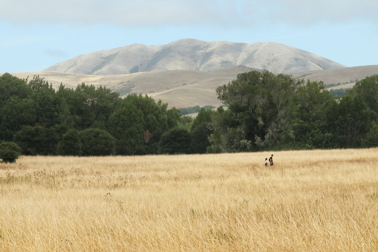
Overview: This gentle trail leads from the Bear Valley Visitor’s Center (part of the Point Reyes National Seashore) and through a scenic meadow before entering a dense forested habitat, dappled with gentle creeks. It’s a great trail for young kids on bikes, strollers, wheelchairs or for folks just looking for an easy trail through the park.
Before you get back in the car, note that the Bear Valley Visitor’s Center is a must-see. The interpretive displays are fun for all ages and the gift shop, to be honest, has a great collection of naturalist books and knick-nacks. We always get sucked in there.
The recreated Coast Miwok village site, Kule Loklo, is also nearby and offers a great chance to learn more about Marin’s indigenous community and their deep relationship with this landscape.
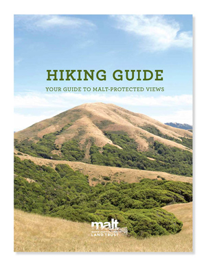
Download your copy today!
Distance: up to 22 miles round trip (shorter options available!)
Elevation gained: 2,470 ft
Wheelchair accessible: No
Dog-friendly: Yes, on-leash only
Find driving directions by clicking here
Restroom: No
Managing Agency: National Park Service
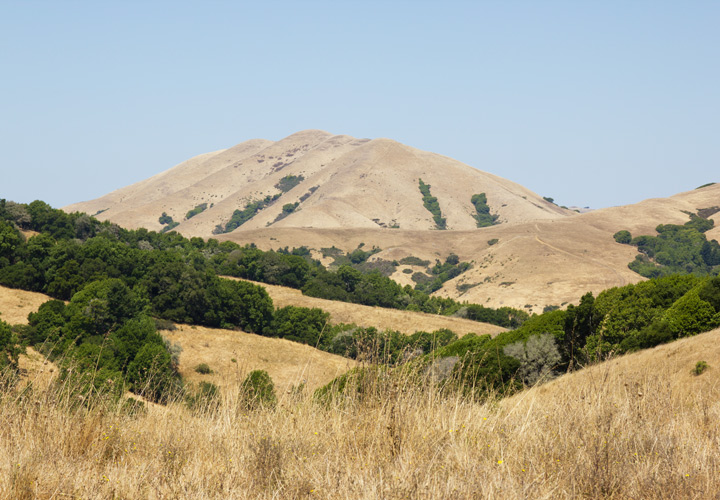
Overview: Offering some of the best vistas in the area, the Bolinas Ridge Trail makes for an incredible introduction to the sweeping landscapes of West Marin. With 360 degree views of the surrounding ranch and farmland, this out and back is what hiking in West Marin is all about.
The first 2.4 miles gradually ascend an open ridgeline, offering sweeping views of Olema Valley to the west, Tomales Bay to the northwest, and MALT-protected Black Mountain to the north. This makes for a wonderful, shorter, out-and-back on its own (4.8 mile round trip). From here, the trail skirts the trees along the ridge, before entering groves of coastal forest at 5.5 miles then California chaparral, before dropping back into redwood forest.
The Bolinas Ridge Trail spans 11 miles from its northern trailhead along Sir Francis Drake Boulevard to its southern terminus on the Fairfax-Bolinas Road. It makes a great bike ride but the first mile is usually as far as our family makes it—and it’s stunning! Retrace your steps at any point to complete this hike.
Distance: 10.5 mile round trip (shorter options available)
Elevation gained: 1,328 ft
Wheelchair accessible: No
Dogs: Nope, ugh, sorry
Find driving directions by clicking here
Restroom: Yes
Wheelchair accessible: No
Managing Agency: National Park Service
Overview: Tucked into this sheltered, coastal valley — where the fog rolls in thick and lingers into the morning — the Olema Valley showcases the wetter, more forested habitat of our local landscapes. Follow this trail through a lush forest of Douglas fir, California bay laurel and coast redwood trees.
The Olema Valley Trail stretches between two trailheads, Five Brooks Trailhead in the North, and Olema Valley Trailhead in the South. Parking is available at either trailhead (Five Brooks Trailhead has both a restroom, and a much larger parking area) and it’s a fantastic hike from either direction.
Distance: 2.6 mile loop
Elevation gained: 600 ft
Wheelchair accessible: No
Dogs: Only in parking area
Find driving directions by clicking here
Restroom: Yes
Wheelchair accessible: No
Managing Agency: California State Parks
Overview: Although much smaller than the surrounding parkland of Point Reyes, Tomales Bay State Parks offers some of the best views in the area. I can’t seem to get enough of the views looking east into the working ranches and farms of West Marin. We’re lucky – thanks to MALT – the area still looks much as it has for decades.
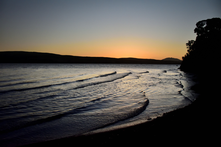
The nearby Hearts Desire Beach is a great place in the summer and fall when the temperatures start to rise. The calm waters of the bay make for great swimming, birding and it’s much safer for kids as there are hardly any waves.
Looking for more great hikes in Marin County?
Download our Hiking Guide here and discover more great views of MALT-protected farm and ranchlands.
The trails await!