Dog-Friendly Trails with Views of Marin’s Farmland

By Matt Dolkas,
Senior Manager, Marketing
June 6, 2025
Calling all dog lovers: Some of Marin County’s best dog-friendly trails are tucked away in its quieter, lesser-known open spaces. And what better way to treat your pup than with a laid-back adventure? These routes are more like leisurely sniffing safaris than strenuous treks — just a few gentle hills and plenty of space to explore.
Our family dog, Mesa, has personally vetted each of these dog-friendly trails. While I might be admiring the sweeping views of Marin’s protected farmland and feeling grateful for all this conserved working land, Mesa’s focused on more important matters: tracing deer tracks, diving nose-first into gopher holes, and savoring every scent these agricultural landscapes serve up.
Here are our favorite dog-friendly trails with views of Marin’s beautiful working lands:
Bolinas Ridge Trail
Distance: up to 11 miles one-way (4.8 miles round trip recommended)
Elevation gained: 2,470 ft (full trail), 800 ft (recommended section)
Wheelchair accessible: No
Restroom: No
Parking fee: No
Managing Agency: National Park Service
Find driving directions by clicking here
Offering some of the best vistas of MALT-protected working landscapes in West Marin, the Bolinas Ridge Trail makes for an incredible introduction to the farmland conservation successes that define this region. With 360-degree views of surrounding ranches and farms, this out-and-back exemplifies what hiking through preserved agricultural landscapes is all about.
The first 2.4 miles gradually ascend an open ridgeline, offering sweeping views of Olema Valley’s cattle ranches to the west, Tomales Bay’s active oyster farms to the northwest, and MALT-protected Black Mountain Ranch to the north. This makes for a wonderful, shorter, out-and-back on its own (4.8 miles round trip).
From here, the trail continues along the ridge, skirting groves of coastal forest before entering California chaparral and eventually dropping into a redwood and Douglas fir forest. The Bolinas Ridge Trail spans 11 miles from its northern trailhead along Sir Francis Drake Boulevard to its southern terminus on the Fairfax-Bolinas Road, but the initial 2.4-mile section described above provides the most comprehensive agricultural viewscapes. Retrace your steps at any point to complete this hike.
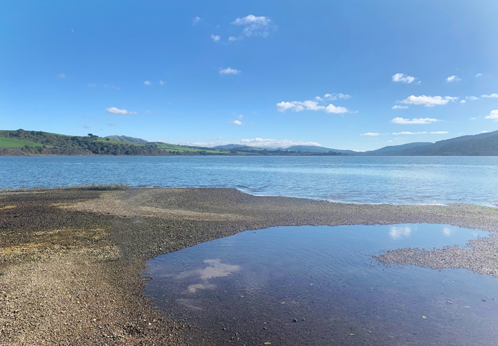
Millerton Point
Distance: 1.2 miles
Elevation gained: 62 ft
Wheelchair accessible: Yes (more info here)
Restroom: Yes
Parking fee: $8
Managing Agency: California State Parks
Find driving directions by clicking here
This gentle trail meanders along the edges of Tomales Bay for world-class views of MALT-protected working ranches and across the water to active oyster farming operations. The viewscape demonstrates the direct connection between terrestrial agriculture and marine aquaculture, where protected grazing lands prevent erosion and nutrient runoff that would compromise the water quality supporting both recreational use and the sustainable aquaculture that makes Tomales Bay oysters world-renowned.
At low tide, enjoy the view of Alan Sieroty Beach (dogs aren’t allowed on the beach) while observing how watershed management on the surrounding protected ranches maintains the Bay’s delicate ecosystem. The working landscapes visible across the water aren’t just scenic—they represent multi-generational ranching families, many of whom have chosen to preserve their agricultural operations while protecting critical habitat.
The relatively easy trail and agricultural vistas make Millerton Point a wonderful impromptu adventure or outing with little ones and dogs alike. It also makes for a fantastic picnicking destination, so be sure to grab some local cheese and bread from the ranches you can see from the trail at the Palace Market in downtown Point Reyes Station.
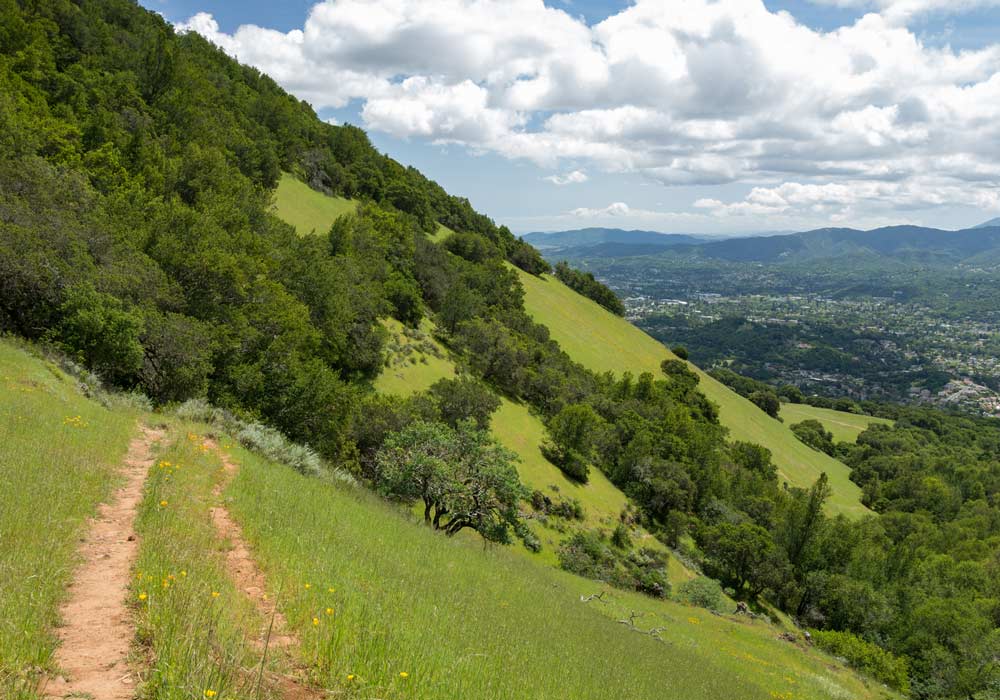
Mount Burdell
Distance: Various options, 2-8 miles
Elevation gained: Up to 1,558 ft
Wheelchair accessible: No
Restroom: Yes
Parking fee: No
Managing Agency: Marin County Parks
Find driving directions by clicking here
Often overshadowed by the popularity of Mount Tamalpais to the south, this county preserve boasts some of the best agricultural viewscapes in the entire North Bay area. With 360-degree views from the summit, it provides unparalleled perspectives on how MALT’s conservation work creates connected blocks of working agricultural land west of Novato and across the broader region.
What makes this landscape particularly fascinating is witnessing cattle still actively grazing the slopes of Mount Burdell itself—a living demonstration of how thoughtful livestock management maintains California’s native grasslands.
Even beyond the agricultural education opportunities, the views from this preserve are world-class, revealing the patchwork of MALT-protected properties that maintain rural character while supporting local food systems and providing critical wildlife habitat.
*Dogs are allowed off leash on this preserve’s fire roads but must remain under voice controll
Keep It Classy: Trail Etiquette for Open Space
Leash Regulations: Check specific trail rules—some open spaces require leashed dogs while others have designated off-leash areas. Follow posted guidelines to ensure everyone’s safety and enjoyment.
Pack It Out: Always carry waste bags and clean up after your dog. Leave no trace by taking waste bags to the nearest trash receptacle to keep these spaces pristine for all visitors.
Wildlife Awareness: These trails offer views of working landscapes that support diverse wildlife. Keep dogs away from nesting areas and wildlife to avoid disturbing natural habitats.
Trail Safety: Stay on designated paths, be aware of other hikers and cyclists, and keep your dog under voice control in off-leash areas.
Have fun exploring these incredible vistas of Marin’s agricultural heritage!