Discovering Native Land Through West Marin’s Geology

By Karisma Wilson,
Former Digital Marketing Manager
April 25, 2025
Whipping around the snaking roads of West Marin in my old Jeep, I pass layers upon layers of prehistoric earth, lush hills of pastureland on one side of the road, and tree covered slopes on the other, criss-crossing the tender skin of the great San Andreas Fault. Here, our region’s history is written in stone—a narrative spanning 200 million years, where each ridge and valley tells a chapter of violent collision, patient erosion, and perpetual transformation. This is a landscape where geology is dynamic, alive, and constantly in motion.
Why Here?
West Marin clearly compels. Despite the endlessly restless foundation, communities have grafted themselves in between the steep, evergreen covered peaks of Inverness Ridge, and the green, rolling hills of Tomales. Beyond the bucolic beauty, there’s another reason agriculture thrives in this region, and it has to do with ancient geological work playing out today.
In our backyard lies a vein of fertile land thanks to millennia of seafloor upheaval that slowly pushed against the edge of the Sierras, creating a rich sediment infill that allows for a diverse and robust local food system.
Cows dot slopes whose soils were once ocean sediments. Oyster farms thrive in the drowned rift valley of Tomales Bay, filtering water while tectonic plates slowly grind against each other miles below. This agricultural tapestry is not separate from geology, but intimately dependent on it. The terroir of West Marin’s organic farms, grass-fed cattle ranches, and artisanal cheese makers embodies millions of years of tectonic drama, translated through root and stem into the food that sustains both community and economy.
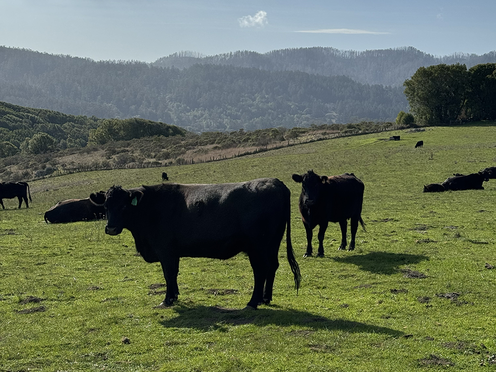 Inverness Ridge’s tree covered hills rise in the background while cows graze on the fertile soil of Bolinas Ridge
Inverness Ridge
Coast Miwok: Tamal-húye
Inverness Ridge stands like a spine along the eastern edge of the Point Reyes peninsula, a granite anomaly in this landscape of low hills and seafloor sediment. Walking through the bishop pines and douglas fir, you’re treading on rock that originated more than a hundred miles southward, carried north by restless Pacific plates.
This area consists of granite torn from its Sierra Nevada birthplace and transported along the San Andreas corridor over millions of years, known by the Coast Miwok as Tamal-húye, “the ridge of bay trees.” Tamal-húye is known for its distinctive flora and its role as a watershed divide. Today, as fog drapes over its shoulders and salamanders seek refuge in its damp ravines, the ridge continues its imperceptible journey northward.
Bolinas Ridge
Coast Miwok: Amá-kotca
The graceful arc of Bolinas Ridge—Amá-kotca or “ridge of deer” to the Coast Miwok—reveals a different chapter of West Marin’s geologic story. Here, the earth’s oceanic crust was thrust upward through a process called obduction, creating a mountain range composed of a chaotic jumble of sediments scraped from the ocean floor as the Farallon Plate slid beneath North America.
Walking these grasslands in spring, wildflowers erupting in technicolor displays, it’s difficult to imagine this soil was once the seabed of an ancient ocean. But the distinctive blue-green serpentinite outcrops of California’s state rock—tell the tale of deep marine origins, formed under immense pressure before being thrust skyward. These rocks harbor toxic levels of heavy metals that most plants cannot tolerate, creating microhabitats where specialized, endemic wildflowers have evolved unique adaptations to survive where others cannot.
Each rainstorm that erodes these hillsides continues the geologic story, slowly carrying fragments of ancient seafloor back toward the ocean in an endless cycle of transformation.
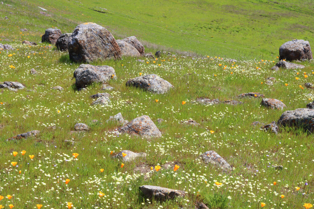 A beautiful bloom of wildflowers can usually be found in areas with serpentine soil
Black Mountain
Coast Miwok: Kule-kotca
Standing atop Black Mountain—Kule-kotca or “wolf ridge” in Coast Miwok tradition—the geological drama of West Marin unfolds in panoramic splendor. The mountain’s distinctive dark coloration comes from its composition of pillow basalt—lava that erupted on the ancient seafloor and cooled rapidly in the cold waters of the Pacific, creating distinctive bulbous shapes resembling pillows.
Watching ravens ride the thermals high above, I’m reminded that this landscape exists in a state of temporary equilibrium. The forces that raised these mountains continue their work, further reshaping this coastline for the generations to come.
Tomales Bay
Coast Miwok: Tamal-Liwa
Tomales Bay represents the most visible expression of the San Andreas Fault. This narrow bay formed approximately 10,000 years ago as sea levels rose following the last ice age, flooding the valley carved out from the fault.
The bay’s eastern shore, composed of Franciscan Complex rocks, stands in stark contrast to its western edge, formed of granitic Salinian terrane. These shores may be neighbors now, but originally formed hundreds of miles apart, now brought together by the inexorable march of plate tectonics.
Coast Miwok shellmounds along these shores contain layers that record both human history and geological events—thin strata of sand that mark ancient tsunamis, evidence of powerful earthquakes that periodically reshaped this coastline. These shellmounds represent a human timeline superimposed upon the much longer geologic one, our narrative forever changing alongside the transformations of the earth.
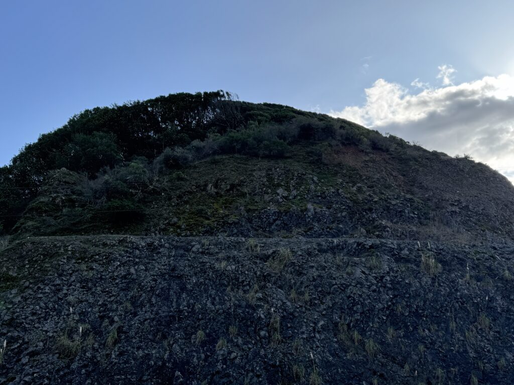 This roadcut near Point Reyes Station shows the unique pillow basalt formed under Black Mountain
A Landscape in Motion
As I navigate the curves of constantly threatened Highway 1, I’m acutely aware that I’m traveling across a landscape that refuses to be static. We move through cycles of livestock, crops, and more, with the West Marin we experience representing a frame in an ongoing geological film—a temporary arrangement of mountains, valleys, and shorelines in constant flux.
I smell the onion grass that lines the highway, making my mouth water as I navigate home, conjuring up a recipe that will perfectly complement my geological journey. With fresh Hog Island oysters in tow, I’ve got a great foundation, their salty brine perfectly representing the rocky shores I call home. I’ll probably pair it with a Point Reyes Farmstead Truffle Toma Mac & Cheese, that always reminds me of the grass covered hills of Tomales, their lush green hue thanks to a fertility ages in the making, the ancient organisms that once called the ocean home, now flavoring the region.
How would you represent West Marin with local ingredients?